march_19_2018_shore_island_isabela_elevation_transect
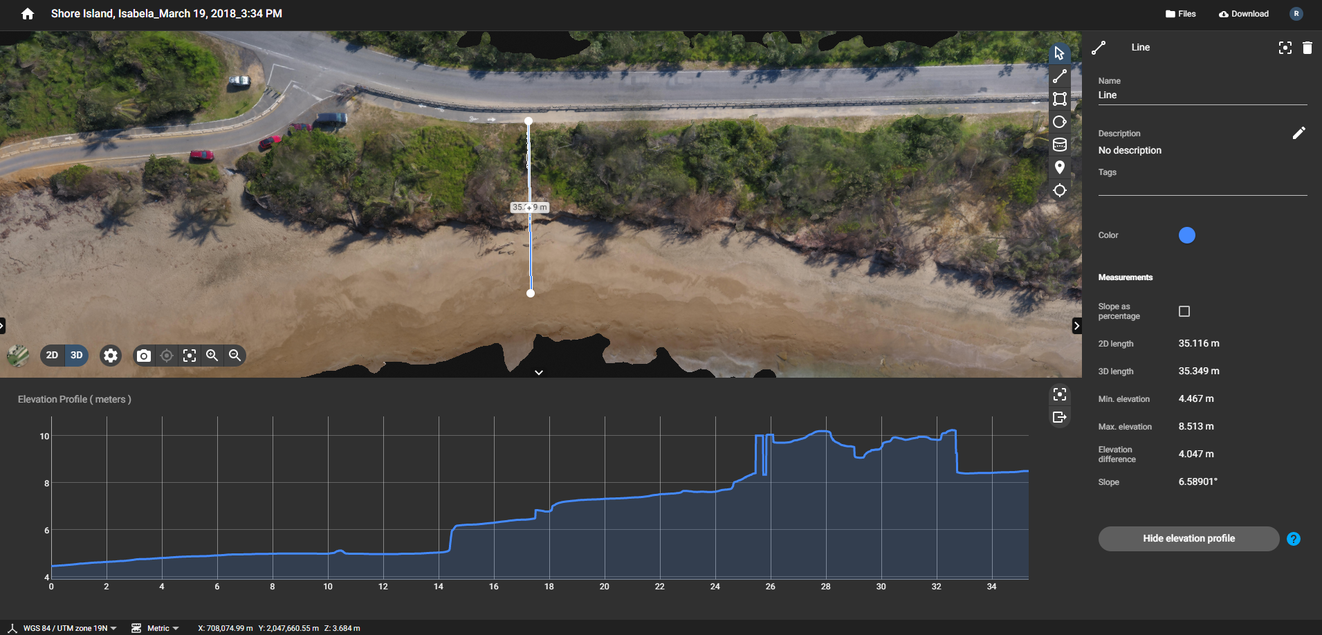
This is data for a pre-project 35 m long elevation transect starting on the shoreline to where PR-466 starts. The geographical coordinate data are in UTM.
Additional Information
| Field | Value |
|---|---|
| Data last updated | November 8, 2021 |
| Metadata last updated | November 8, 2021 |
| Created | November 8, 2021 |
| Format | PNG |
| License | Creative Commons Attribution |
| Datastore active | False |
| Has views | True |
| Id | 679d8826-f4be-4cce-aa74-a1acaedf9925 |
| Mimetype | image/png |
| Package id | 93037936-4bde-4361-8235-ff717685087b |
| Position | 12 |
| Size | 1.7 MiB |
| State | active |
| Url type | upload |